

02/28/2024 6:30AM EST
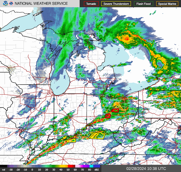
As the storm starts to reach the end of Ohio, we have reports of 1 Tornado in Western Ohio and another Tornado in Eastern Michigan. We will continue to monitor the storms as they start to die down.
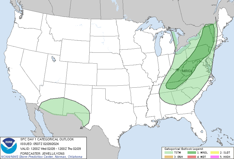
And as we look into tonight. Marginal Risk of Thunderstorms into the North East. Along with Freezing Temperatures in the Midwest.
02/28/2024 5:45AM EST
As the morning continues, a second round of storms is starting to enter Central indiana. This storm does not appear to be able to make tornadoes, but it is producing heavy rain and high winds.
02/28/2024 5:15AM EST
As we get into the morning, we are getting reports of smaller debris in Central Indiana. Please be on the lookout on your morning commute for smaller debris along the road.
02/28/2024 4:50AM EST
The Storm has passed through Indiana, leaving behind only wind damage. The Cell from Chicago spawned one more tornado over Southern Michigan. And Central and Southern Ohio are currently under a Tornado Watch.
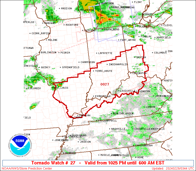
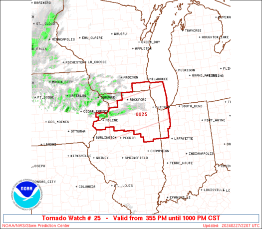
02/27/2024 10:25PM EST
By Sean Bentley
The National Weather Service (NWS) Storm Prediction Center in Norman, Oklahoma has issued a Tornado Watch for large portions of southern Illinois, southern and central Indiana, northern Kentucky, and southwestern Ohio. The watch is in effect from 10:25 PM EST on Tuesday, February 27th until 6:00 AM EST on Wednesday, February 28th.
02/27/2024 9:50PM EST
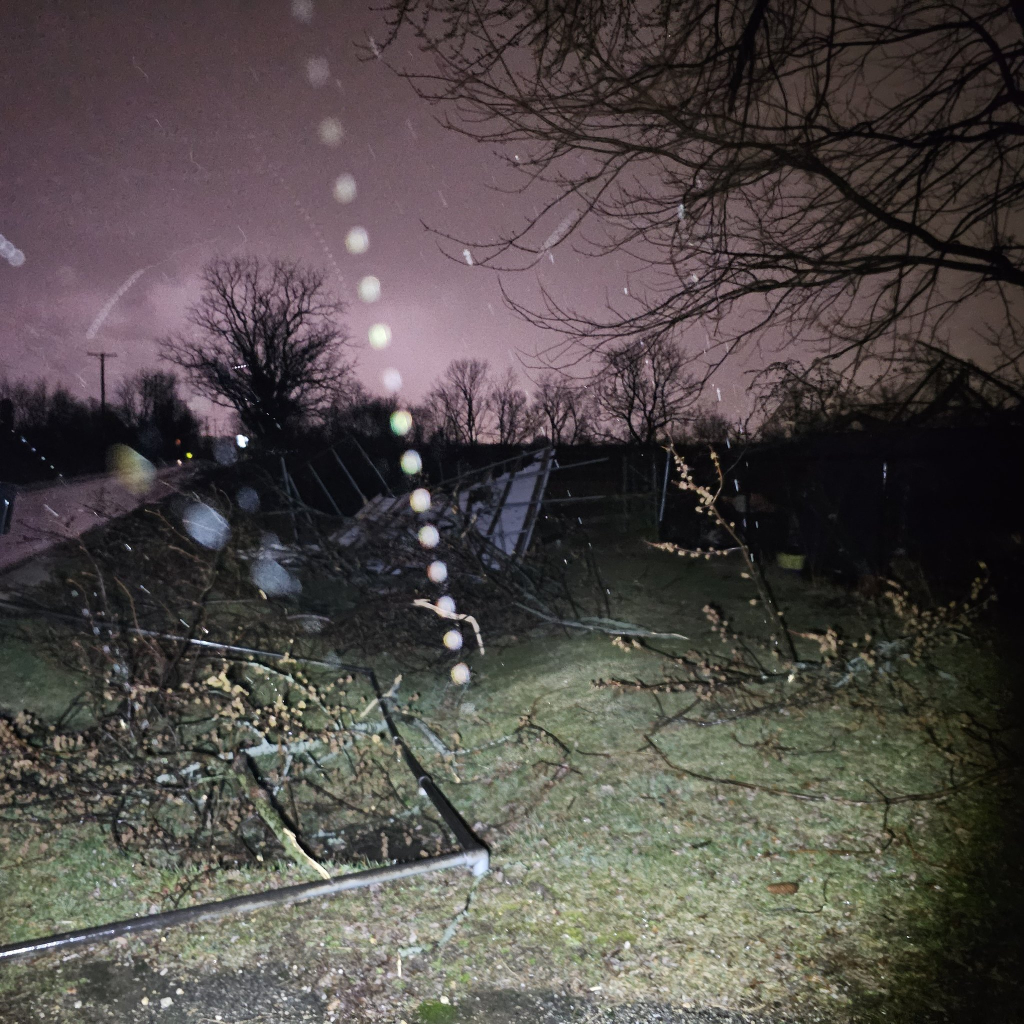
As the storm moves out of Chicago and into Lake Michigan we are starting to see the extent of the damage. From Hail Damage to a Barn being Blown Down. The damage looks bad in certain parts.
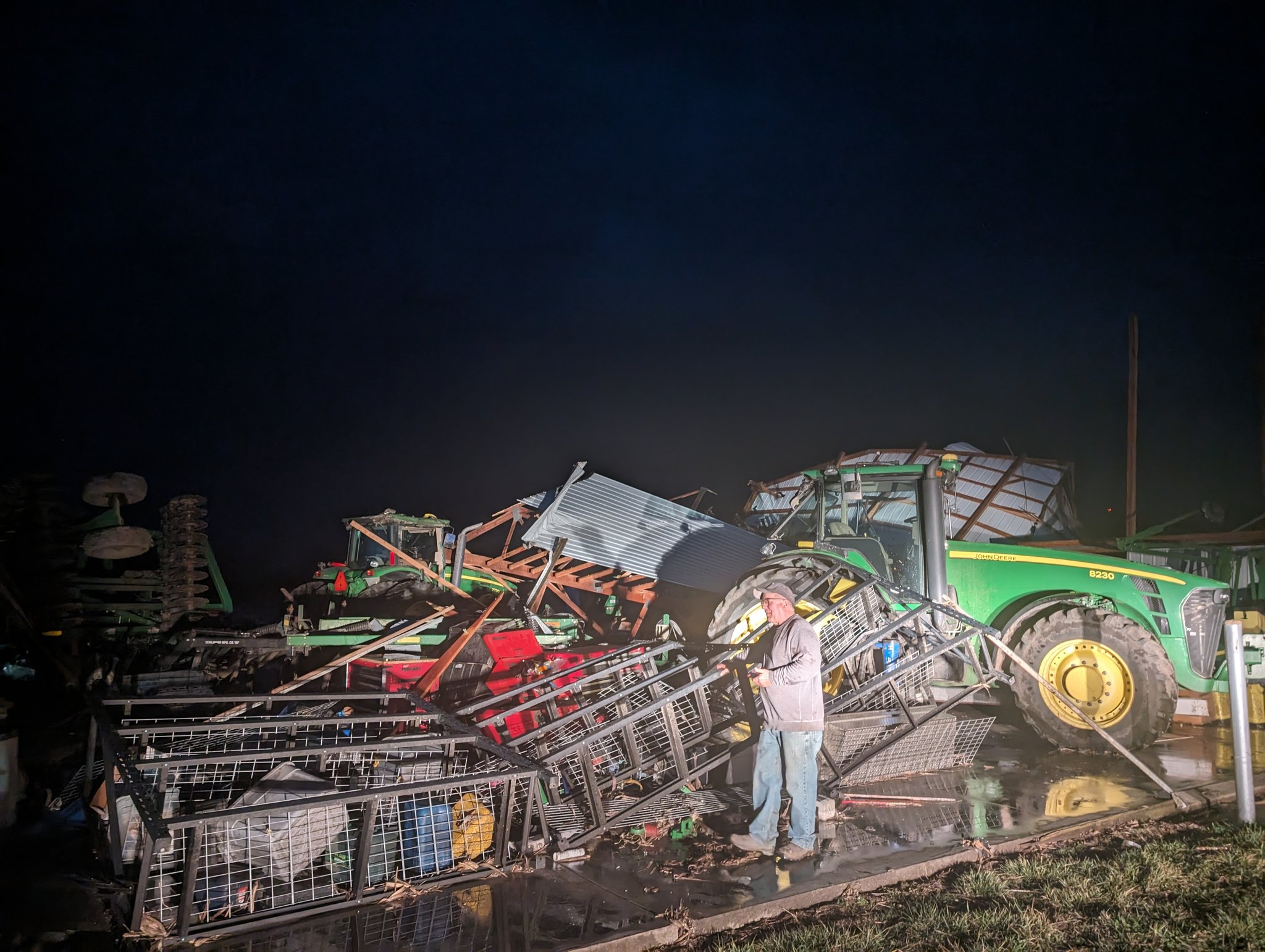
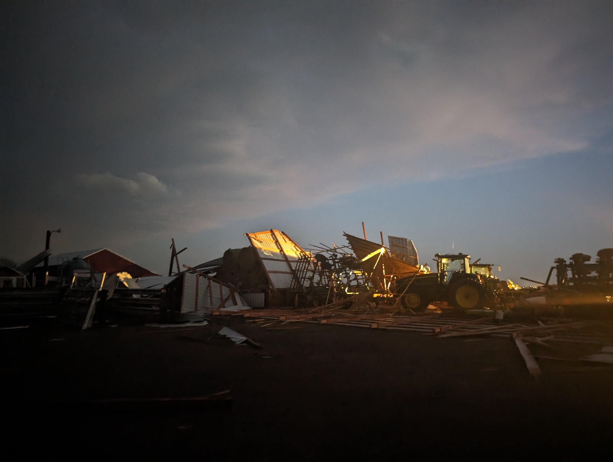
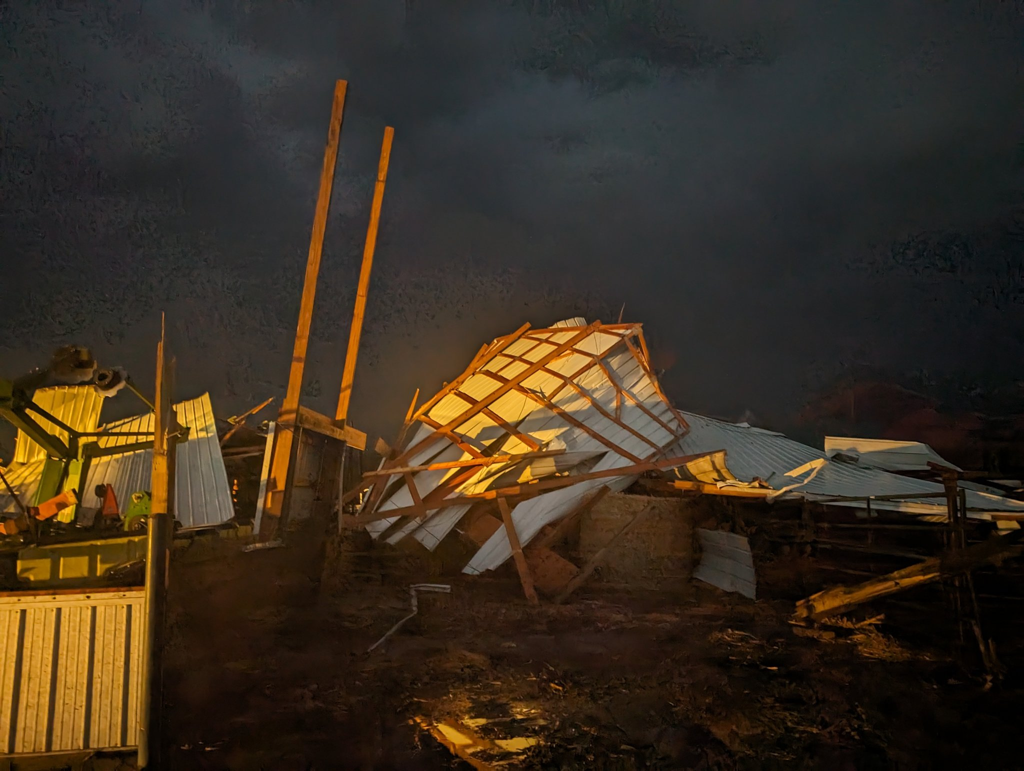
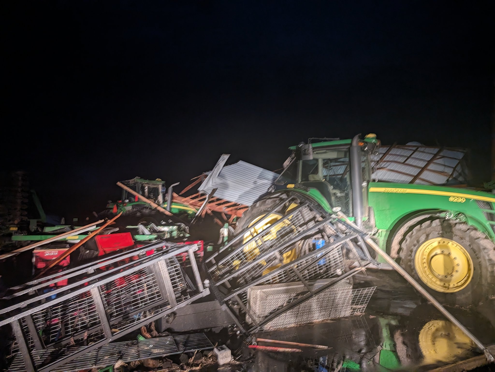
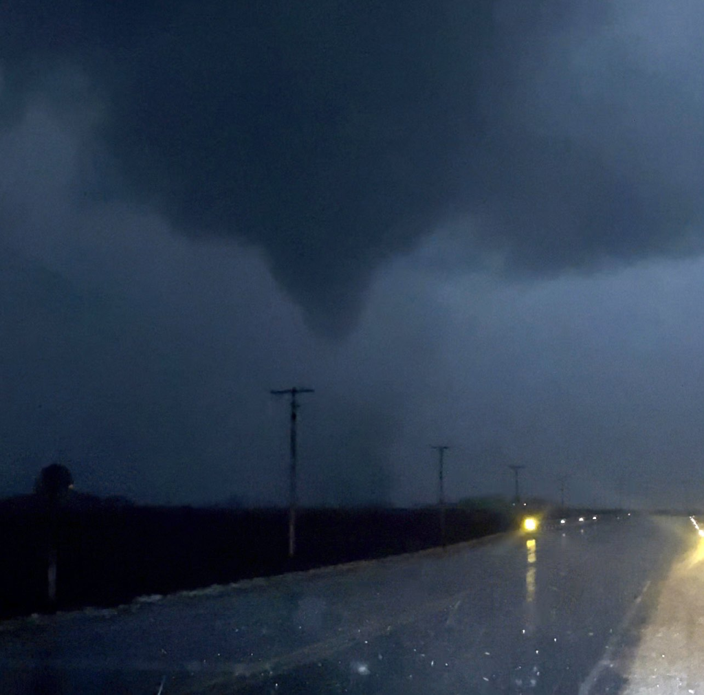
Annawan, IL | Credit to Jesse Risley on X (formally Twitter) at around 7:35 PM EST
02/27/2024 9:15PM EST
We are seeing images and reports of Tornado and Hail Damage throughout Northern Illinois and Chicago.
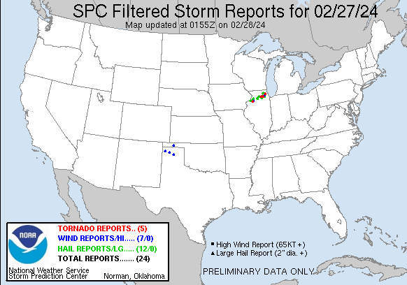
We are up to 5 Reports of Tornados, 12 Reports of Large Hail, and 3 Reports of High Winds.
02/27/2024 8:15PM EST
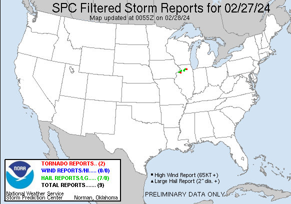
So far with this storm along northern Illinois, we have seen 7 reports of Large Hail, and 2 reports of Active Tornados on the ground.
02/27/2024 5:10PM EST
The National Weather Service has issued a Tornado Watch for Northern Illinois, South Eastern Wisconsin, and North Western Indiana. All Those in that area, please monitor your local news stations for more information if you live in these areas.
02/27/2024 5:00PM EST
The NOAA Storm Prediction Center has updated the Storm Prediction and now there are 2 spots of Enhanced Catagory. One is over and around Chicago Area, and the other is Southern Illinois to Southern Ohio. Keep up to date with your local weather channels.
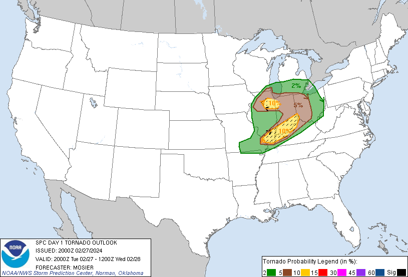
The Tornado Chance also goes with the storm Catagories. Those in that area need to charge devices and prepare for tornados.
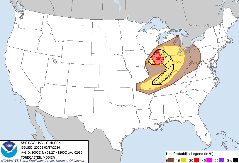
And the Hail Chance had become a 30% near and around Chicago, but has moved out of Central Illinois and become smaller in Indiana.