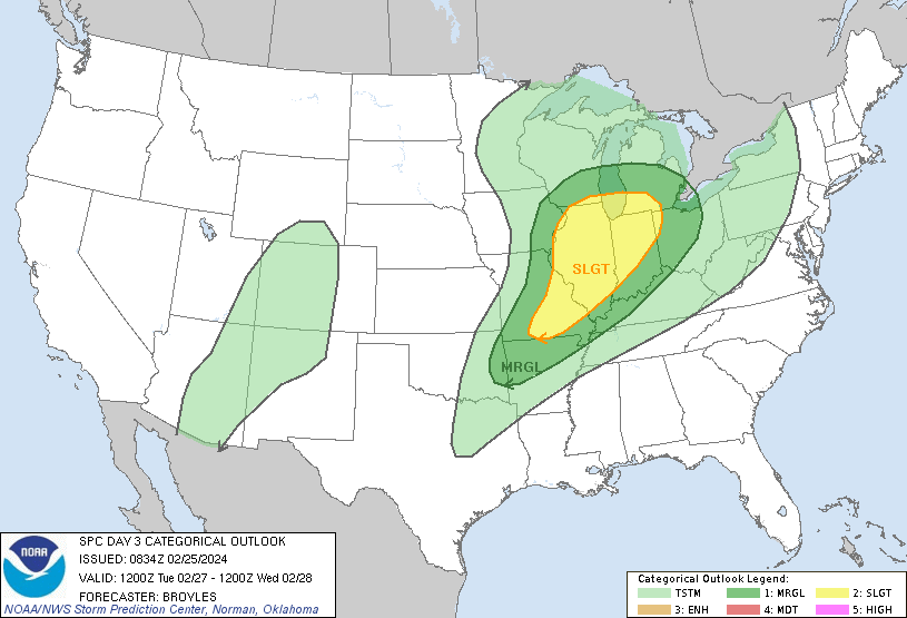
There is a chance of scattered strong to severe thunderstorms Tuesday night into Wednesday morning across parts of the Ozarks, Mid Mississippi Valley, and Southwestern Great Lakes. The main threats will be isolated wind damage, hail, and possibly a few tornadoes.
The storms are expected to develop ahead of a cold front moving southeastward into the region. While low-level moisture is forecast to be weak, increasing large-scale ascent is expected to be sufficient for thunderstorm development. Forecast wind shear and instability values suggest the potential for strong to severe updrafts.
The NOAA Storm Prediction Center has issued a Slight Risk for severe thunderstorms for the affected area. However, there is still some uncertainty about the magnitude of the severe threat due to the weak moisture return and the later timing of the storms.
It is important to stay weather aware and have a plan in place in case severe weather threatens your area.

